USGS 24k Digital Raster Graphics Topographic Map
This map is locally hosted at boydsmaps.com
Link to this metadata:
boydsmaps.com/mapinfo/drg24k.html
Link to this map:
boydsmaps.com/#14.00/40.441732/-79.989801/drg24k/0.00/0.00
Originally published:
May 26, 2025
Most recent update:
June 13, 2025
Resolution:
8 feet (2.4 meters)
Map Tiles:
7,092,000
Size:
76.5 gb
Data Sources
United States Department of AgricultureDescription
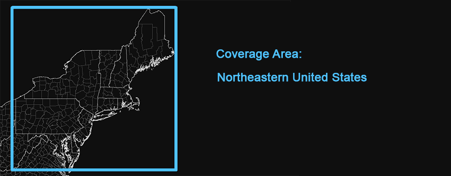
Note: This map only covered the US Mid Atlantic when it was initially released but was expanded to the entire Northeastern US on 6/13/2025. The infomation below has been updated to reflect the changes to the original version.
Digital raster graphics (DRG) topographic maps were produced from 1995 to 1998 by the US Geological Survey through a partnership with Land Information Technology Company of Aurora, Colorado. The original paper maps were scanned at a resolution of 250 dots per inch and converted to a special 11-color palette. Although the resolution is high enough, the limited color palette resulted in artifacts and reduced clarity.
According to a 2001 USGS report, national DRG coverage was completed by 1998 but they continued updating about 1000 maps to new versions each year. It is not quite clear when production of the DRG topo's ended. The DRG's were popularized through Microsoft Terraserver, TopoZone and other sites initially. The USGS offered them for download through their seamless server but that was discontinued many years ago. Today, they are getting hard to find online, which was a primary motivation for creating this map.
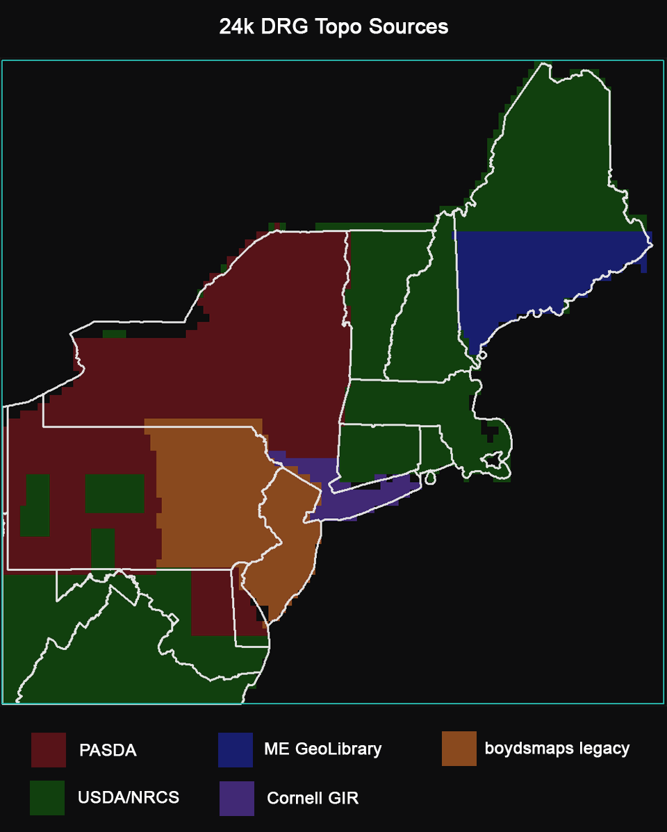
In spite of their shortcomings, we feel the DRG Topo's have enough historical significance to host them. It was a bit of a challenge to find sources in 2025 however. The source for New Jersey and Eastern Pennsylvania is actually boydsmaps legacy terraserver imagery, downloaded with USAPhotoMaps software around 2004. Cornell University has county mosaics of the New York 24k DRG's which we used for parts of Eastern New York and Long Island. Pennsylvania Spatial Data Access (PASDA) is a great resource for the full, original DRG quadrangles as individual maps, complete with collars and title blocks. About one third of the 4,113 USGS quadrangles in this map were downloaded from PASDA and processed to remove the collars.
In the original version of this map, we were unable to find DRG topo's for Connecticut, Rhode Island or Massachussets. But we subsequently found DRG county mosaics for every state at the USDA NRCS Geospatial Data Gateway and replaced the other maps with authentic DRG topo's. The NRCS mosaics are a terrific resource that were used for almost 2,000 USGS quads in this map. Unfortunately, there are noticeable artifacts resulting from heavy data compression. As per the NRCS metadata, the county mosaics are "...compressed to a ratio of about 1:20 to save on storage requirements and to accelerate computer processing and display."
We used a map service from the Maine GeoLibrary for the Southern part of that state, but the server was so slow that after a day of downloading, we switched to the NRCS mosaics for Northern Maine. The graphic below shows the approximate coverage of different DRG sources used in this map.
The 24k DRG topos are shown at zoom levels 14, 15 and 16. 100k DRG's are displayed at zoom level 13 and 250k DRG's are shown at levels 5 through 12. Finding sources for the 100k and 250k DRG maps was even more difficult. The Southern parts of the map were downloaded from PASDA but no source was found for the Northern states. For these areas, we used 100k and 250k maps downloaded from the USGS Historical Topographic Map Collection. To make these match the original DRG's, we used a custom palette with colors similar the original 11-color DRG palette.
This map also provides period-correct topos for the boydsmaps terraserver translator which can open old links to the now-discontinued website.
Please see our 24k Legacy Topo for a higher quality version of these maps. You can compare the two versions with our MapSync App.
Resources
See the following USGS document for information about the symbols that are used on topographic maps:
boydsmaps.com/mapinfo/docs/topo_map_symbols.pdfA USGS document explaining topographic map scales is available here:
boydsmaps.com/mapinfo/docs/topo_map_scales.pdfUSGS 1999 digital raster graphics report:
boydsmaps.com/mapinfo/docs/drg_report_1999.pdfUSGS 2001 digital raster graphics report:
boydsmaps.com/mapinfo/docs/drg_report_2001.pdfCredits
United States Geological Survey (USGS), Land Information Technology Co, Ltd, US Department of Agriculture Natural Resources Conservation Service (USDA NRCS), Pennsylvania Spatial Data Access (PASDA), Maine Library of Geographic Information, Cornell University Geospatial Information Repository (CUGIR), USGS Historic Topographic Map Collection
Distribution Liability
The U.S. Geological Survey makes no expressed or implied warranty regarding the accuracy or utility of the data for general or scientific purposes, nor shall the act of distribution constitute any such warranty. This disclaimer applies both to individual use of the data and aggregate use with other data. The U.S. Geological Survey shall not be held liable for improper or incorrect use of the data described and/or contained herein.
Map software is provided "as is.", without any express or implied warranty. In no event will boydsmaps.com be held liable for any damages arising from the use of this software. The user assumes all risks associated with the use of this software. boydsmaps.com will not be held responsible for any inaccuracies and no responsibility is assumed for damages or other liabilities due to errors, installation, accuracy, availability, use or misuse of the data presented.