USGS National Map Topo 2023 (locally-cached version)
US Geological Survey National Geospatial Technical Operations Center
Data Source
This map is locally hosted at boydsmaps.com
Link to this metadata:
boydsmaps.com/mapinfo/ustopo2023.html
Link to this map:
boydsmaps.com/#15.00/40.441732/-79.990058/ustopo2023/0.00/0.00
Originally published:
December 30, 2022
Most recent update:
April 6, 2025
Resolution:
8 feet (2.4 meters)
Map Tiles:
13,000,000
Size:
92.5 gb
Description (boydsmaps version)
This map is a locally-cached version of the USGS National Map Topo as of January 1, 2023. It provides a contemporary companion to the USGS 24k Legacy and 62k Historic topos and loads much faster than the version on USGS servers. Note that the resolution of this map was doubled on 4/6/2025 with full level 16 coverage. It now provides the same level of detail as the remotely-hosted version from USGS servers.
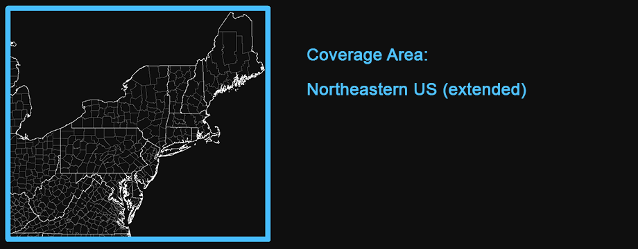
The map includes full coverage of Connecticut, Delaware, Maine, Maryland, Massachussets, New Hampshire, New Jersey, New York, Ohio, Pennsylvania, Rhode Island, Vermont, Virginia and West Virginia with partial coverage of Kentucky, Tennessee, Indiana and Michigan. While it would be nice to expand the coverage of this map someday, there are no plans to do that in the foreseeable future.
Original USGS Description
USGS Topo combines the most current data in The National Map (TNM), and other public-domain data, into a multi-scale topographic reference map. Data themes included are Boundaries, Geographic Names, Transportation, Contours, Hydrography, Land Cover, Shaded Relief, and Bathymetry. This service is designed to provide a seamless view of TNM data in a geographic information system (GIS) accessible format.
Credits
U.S. Geological Survey (USGS)
Use Constraints
None. Acknowledgement of the originating agencies would be appreciated in products derived from these data.
Distribution Liability
Although these data have been processed successfully on a computer system at the U.S. Geological Survey, no warranty expressed or implied is made regarding the accuracy or utility of the data on any other system or for general or scientific purposes, nor shall the act of distribution constitute any such warranty. This disclaimer applies both to individual use of the data and aggregate use with other data.
It is strongly recommended that these data are directly acquired from a U.S. Geological Survey server, and not indirectly through other sources which may have changed the data in some way. It is also strongly recommended that careful attention be paid to the contents of the metadata file associated with these data. The U.S. Geological Survey shall not be held liable for improper or incorrect use of the data described and/or contained herein.
Map software is provided "as is", without any express or implied warranty. In no event will boydsmaps.com be held liable for any damages arising from the use of this software. The user assumes all risks associated with the use of this software. boydsmaps.com will not be held responsible for any inaccuracies and no responsibility is assumed for damages or other liabilities due to errors, installation, accuracy, availability, use or misuse of the data presented.
Full Metadata Link
catalog.data.gov/dataset/