Northeast US OpenTopoMap (local cache)
Data Source
This map is locally hosted at boydsmaps.com
Link to this metadata:
boydsmaps.com/mapinfo/usopentopo.html
Link to this map:
boydsmaps.com/#10.00/44.225474/-71.305313/usopentopo/0.00/0.00
Originally published:
June 11, 2024
Most recent update:
none
Resolution:
16 feet (4.8 meters)
Map Tiles:
1,100,000
Size:
33 gb
Description
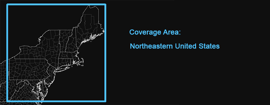
This map is a locally-cached, full-resolution version of OpenTopoMap with coverage of the Northeastern US region (New Jersey, New York, Pennsylvania, Maryland, Delaware, Connecticut, Rhode Island, Massachusetts, New Hampshire, Vermont and Maine with partial coverage of Virginia and West Virginia). This map was downloaded in 2024, but as per their Wiki, work on OpenTopoMap ceased in January 2023 and the map has not been updated since then.
Original Data Source and Information
https://www.openstreetmap.org/
OpenTopoMap is a free, topographic map that is generated from OpenStreetMap and SRTM height data. The map style is based on the official maps and relies on good readability through high contrast and balanced text. OpenStreetMap is built by a community of mappers that contribute and maintain data about roads, trails, cafés, railway stations, and much more, all over the world. OpenStreetMap emphasizes local knowledge. Contributors use aerial imagery, GPS devices, and low-tech field maps to verify that OSM is accurate and up to date.
OpenStreetMap's community is diverse, passionate, and growing every day. Our contributors include enthusiast mappers, GIS professionals, engineers running the OSM servers, humanitarians mapping disaster-affected areas, and many more.
Credits
Map Data: © OpenStreetMap-Mitwirkende, SRTM
Map Style: © OpenTopoMap (CC-BY-SA)
Use Constraints
OpenTopoMap is licensed under the CC-BY-SA license. This means that the map may be used free of charge and freely, as long as it is always assigned and the transfer is possible under the same conditions. The map style is under the same license and can be accessed via Github. (translated from German with Apple Safari)
OpenStreetMap® is open data, licensed under the Open Data Commons Open Database License (ODbL) by the OpenStreetMap Foundation (OSMF). You are free to copy, distribute, transmit and adapt our data, as long as you credit OpenStreetMap and its contributors. If you alter or build upon our data, you may distribute the result only under the same licence. The full legal code explains your rights and responsibilities.The cartography in our map tiles, and our documentation, are licensed under the Creative Commons Attribution-ShareAlike 2.0 license (CC BY-SA).
https://wiki.osmfoundation.org/wiki/Terms_of_UseDistribution Liability
Map software is provided "as is", without any express or implied warranty. In no event will boydsmaps.com be held liable for any damages arising from the use of this software. The user assumes all risks associated with the use of this software. boydsmaps.com will not be held responsible for any inaccuracies and no responsibility is assumed for damages or other liabilities due to errors, installation, accuracy, availability, use or misuse of the data presented.