Boyd's Map of the Pines 2023
© 2023 Boyd Ostroff
Data Source
This map is locally hosted at boydsmaps.com
Link to this metadata:
boydsmaps.com/mapinfo/pines2023.html
Link to this map:
boydsmaps.com/#15.00/39.752096/-74.465159/pines2023/0.00/0.00
Originally published:
December 24, 2023
Most recent update:
none
Resolution:
4 feet (1.2 meters)
Map Tiles:
520,000
Size:
1.77 gb
Description
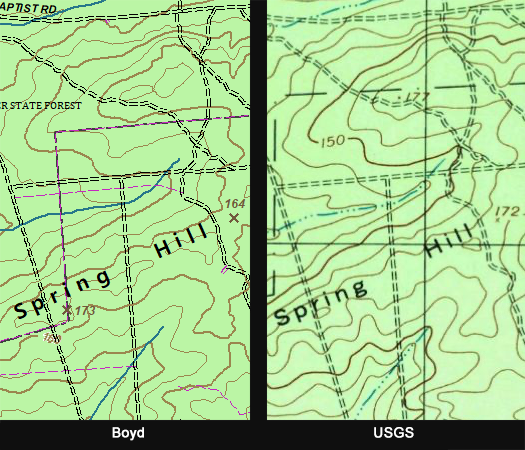
This map is the newest in the Boyd's Map of the Pines series which dates back to 2008 and was last updated in 2020. Although it was created from contemporary data, an attempt was made to adhere to the style of traditional USGS 24k paper topographic maps.
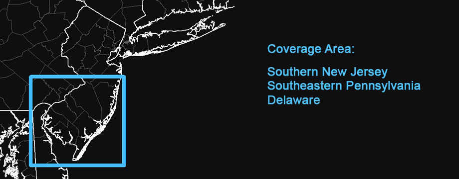
Resolution is 4 feet (1.2 meters) per pixel, over twice the resolution of traditional USGS 24k topo maps. Coverage area includes Southern New Jersey with portions of Southeastern Pennsylvania, Delaware and Maryland. But the focus is on the New Jersey Pine Barrens and considerable attention was paid to detail in this region. The Pennsylvania, Delaware and Maryland sections haven't received this level of attention and are virtually unchanged from older versions of the map.
For purposes of identification, unpaved roads from the USGS topo maps are shown in black while roads from other sources (such as nineteenth century topo maps, aerial and LIDAR imagery) are shown in a purple color - see the examples below. Although the unpaved roads on this map have been compared to the USGS topo, absolutely no representations are made regarding accuracy. Some roads may be missing or inaccurately represented. Unpaved roads in the Pennsylvania, Delaware and Maryland maps are based on OpenStreetMap data and not the USGS.
Credits
Transportation
Public Openspace
Hydrography
Structures
Land Use/Land Cover
Other
Distribution Liability
Map software is provided "as is", without any express or implied warranty. In no event will boydsmaps.com be held liable for any damages arising from the use of this software. The user assumes all risks associated with the use of this software. boydsmaps.com will not be held responsible for any inaccuracies and no responsibility is assumed for damages or other liabilities due to errors, installation, accuracy, availability, use or misuse of the data presented.
The user should not assume they are permitted to drive or walk on a road or trail just because it appears on this map. Some of the roads and trails shown may be on private property or may have regulations prohibiting vehicular or other use. Some roads may not be passable and could be dangerous. It is the sole responsibility of the user to determine the suitability of any road shown on this map.
Boundaries shown for parcels, openspace and military installations are approximate and may contain significant errors. Some areas indicated as openspace may be not be open to access by the general public. It is the responsibility of the user to independently determine if they are permitted in these areas.
This map contains NJDEP Bureau of GIS digital data but has not been verified by NJDEP and is not state-authorized.