1949 in the Pines
© 2021 Boyd Ostroff (Data from the USGS Historical Topographic Map Archive)
Data Source
This map is hosted locally at boydsmaps.com
Link to this metadata:
boydsmaps.com/mapinfo/pines1949.html
Link to this map:
boydsmaps.com/#14.00/39.898668/-74.596590/pines1949/0.00/0.00
Originally published:
August 29, 2021
Most recent update:
none
Resolution:
16 feet (4.8 meters)
Map Tiles:
33,000
Size:
1.66 gb
Description
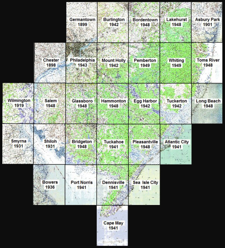
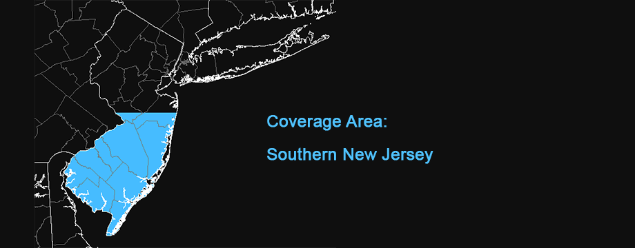
A seamless collection of twenty nine Southern New Jersey USGS 1:62,500 historical topographic maps from the middle of the 20th century. These maps were the precursors to the 1:24,000 scale (24k) USGS topo maps and an upgrade to the 19th century topos because they contained forest shading and other features that give them a more modern look. But the 1:62,500 scale does not allow for as much detail as the newer 24k topographic maps which began replacing them in the early 1950's.
To create the map, individual PDF files were downloaded from the USGS Historical Topographic Map Collection and converted to GeoTIFF format. Color correction was applied in Photoshop, the collars were removed, they were joined into a seamless geoTIFF file and finally converted to a tiled format for online use.
Credits
Original maps from the US Geological Survey Historical Topographic Map Collection
www.usgs.gov/core-science-systems/ngp/topo-mapsDistribution Liability
Although these data have been processed successfully on a computer system at the U.S. Geological Survey, no warranty expressed or implied is made regarding the accuracy or utility of the data on any other system or for general or scientific purposes, nor shall the act of distribution constitute any such warranty. This disclaimer applies both to individual use of the data and aggregate use with other data. It is strongly recommended that these data are directly acquired from a U.S. Geological Survey server, and not indirectly through other sources which may have changed the data in some way. It is also strongly recommended that careful attention be paid to the contents of the metadata file associated with these data. The U.S. Geological Survey shall not be held liable for improper or incorrect use of the data described and/or contained herein.
The digital version of the historical map was georeferenced with a methodology that preserves, but does not exceed, the accuracy of the original map. The historical map product was compiled to meet National Map Accuracy Standards (NMAS) of the era when the map was originally published. Users should be aware that temporal changes may have occurred since this map was originally produced and that some parts of this data may no longer represent actual surface conditions. Users should not use this data for critical applications without a full awareness of its limitations.
Map software is provided "as is", without any express or implied warranty. In no event will boydsmaps.com be held liable for any damages arising from the use of this software. The user assumes all risks associated with the use of this software. boydsmaps.com will not be held responsible for any inaccuracies and no responsibility is assumed for damages or other liabilities due to errors, installation, accuracy, availability, use or misuse of the data presented.