2017 USDA National Agriculture Imagery Program Orthophotography
© 2025 Boyd Ostroff
This map is locally hosted at boydsmaps.com
Link to this metadata:
boydsmaps.com/mapinfo/naip2017.html
Link to this map:
boydsmaps.com/#16.00/41.099160/-75.391997/naip2017/0.00/0.00
Originally published:
August 29, 2021
Most recent update:
April 15, 2025
Resolution:
4 feet (1.2 meters)
Map Tiles:
5,185,000
Size:
29.11 gb
Data Sources
USDA Natural Resources Conservation Service (NRCS)Description
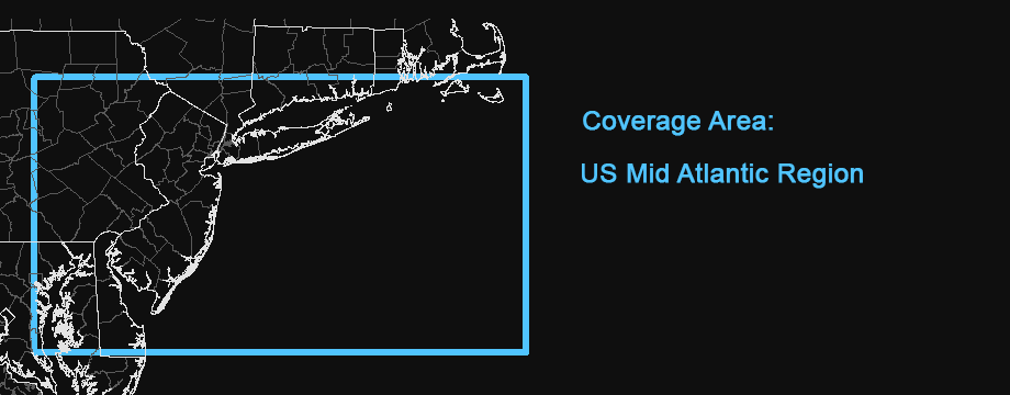
2017 aerial imagery from the US Department of Agriculture (USDA) National Agriculture Imagery Program (NAIP), stitched together into a seamless map. 2016 imagery was used for Connecticut, Massachussets and Rhode Island. The Long Island imagery is from an older map that was previously published at boydsmaps and has now been replaced with this map.
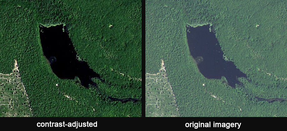
The Southern New Jersey imagery was originally processed in 2019 for personal use but not published. It has been contrast-adjusted to enhance the forested areas, but this causes lighter details to be "blown out" in some places. After some consideration, it was decided that the overall effect was an improvement.
Northern New Jersey imagery was also contrast-adjusted but in a less aggressive manner. All of the New Jersey imagery comes from the New Jersey Geographic Information Network (NJGIN) while the other states were downloaded directly from the NAIP.
The NAIP data is provided as individual downloads for each county, but the actual coverage area is larger and requires cropping when assembling into a regional map. To facilitate this, we cropped them to the county shapefiles from the USGS National Boundary Dataset. This worked well in most places, but caused problems in some coastal areas because the low-resolution shapefiles do not quite match the actual coastline. Some of the problems were corrected by manually cropping but others can be seen in coastal parts of Maryland, Connecticut and Rhode Island. This is the first of a series of regional NAIP maps, so we will look for ways to improve this in the future.
The NAIP acquires digital ortho imagery during the agricultural growing seasons in the continental US. A primary goal of the NAIP program is to enable availability of ortho imagery within one year of acquisition. Imagery is typically available for distribution within 60 days of the end of a flying season and is intended to provide current information of agricultural conditions in support of USDA farm programs. NAIP imagery is generally acquired in projects covering full states in cooperation with state government and other federal agencies who use the imagery for a variety of purposes including land use planning and natural resource assessment. The NAIP is also used for disaster response often providing the most current pre-event imagery.
Credits
United States Department of Agriculture, Farm Service Administration Aerial Photography Field Office
NJ Office of Information Technology (NJOIT), Office of Geographic Information Systems (OGIS)
New Jersey Geographic Information Network (njgin.nj.gov)
Distribution Liability
In no event shall the creators, custodians, or distributors of this information be liable for any damages arising out of its use (or the inability to use it).
Map software is provided "as-is", without any express or implied warranty. In no event will boydsmaps.com be held liable for any damages arising from the use of this software. The user assumes all risks associated with the use of this software. boydsmaps.com will not be held responsible for any inaccuracies and no responsibility is assumed for damages or other liabilities due to errors, installation, accuracy, availability, use or misuse of the data presented.
NAIP Information
www.fsa.usda.gov/programs-and-services