Kobbe's 1889 Map of the Pines
© 2023, Boyd Ostroff, original maps by Rand, McNally & Co. Engravers
Data Source
This map is locally hosted at boydsmaps.com
Link to this metadata:
boydsmaps.com/mapinfo/kobbe.html
Link to this map:
boydsmaps.com/#12.00/39.848880/-74.289681/kobbe/0.00/0.00
Originally published:
April 4, 2023
Most recent update:
May 22, 2025
Resolution:
32 feet (9.6 meters)
Map Tiles:
11,000
Size:
700 mb
Description
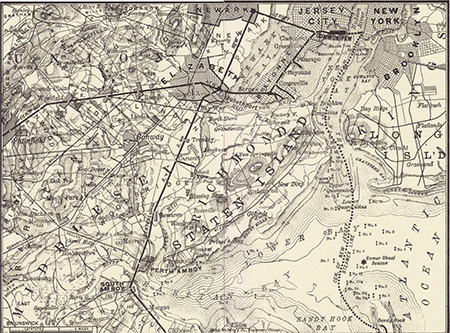
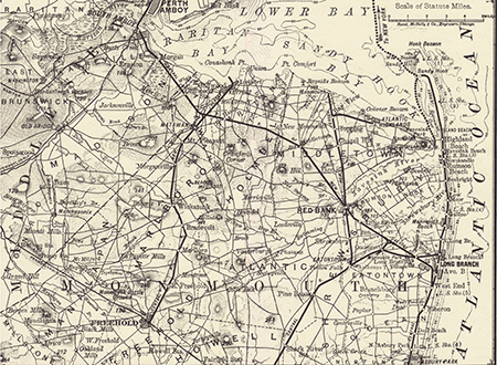
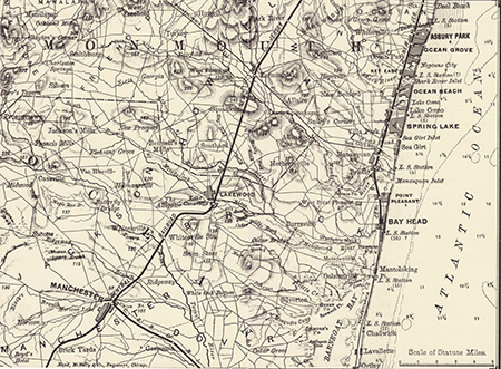
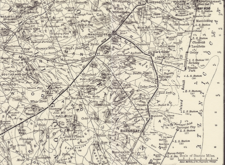
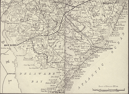
A composite of five individual maps that were originally published in the book "Kobbe's Jersey Coast and Pines" by Gustav Kobbe, Short Hills, New Jersey, 1889. Each map was printed on two facing pages with a size of approximately 6.6 inches x 9.0 inches. The maps were scanned at 1200 dots per inch from the 1977 reprint of the book by Gateway Press, Inc, Baltimore. This edition was limited to 500 copies and reprinted under the sponsorship of the Ocean County Historical Society, Toms River, New Jersey. No copyright is shown.
The scanned maps were georeferenced against USGS 1:250,000 scale topographic maps from the 1940's. Although the imagery was initially processed at a resolution of approximately 8 meters/pixel, they are very inaccurate. The original maps have overlapping coverage areas and were printed at a different scales, with the lowest amount of detail in the Southern map. The Southern map is especially bad, it just doesn't match the true shape of the state. When georeferencing it was necessary to make major corrections which are visible as distortion in the text and wavy lines that should actually be straight.
When creating the seamless composite, individual maps were overlaid in a way that preserved the most detail. The bottom line is that this map is very interesting from a historical perspective, but don't expect any degree of accuracy or detail. The original version was printed in a small book you could carry in your pocket, unlike historical topographic maps on large sheets of paper that covered a whole table-top.
Distribution Liability
Map software is provided "as-is", without any express or implied warranty. In no event will boydsmaps.com be held liable for any damages arising from the use of this software. The user assumes all risks associated with the use of this software. boydsmaps.com will not be held responsible for any inaccuracies and no responsibility is assumed for damages or other liabilities due to errors, installation, accuracy, availability, use or misuse of the data presented.