Boyd's Hybrid Street Map
© 2024 Boyd Ostroff
Data Source
This map is locally hosted at boydsmaps.com
Link to this metadata:
boydsmaps.com/mapinfo/hybrid.html
Link to this map:
boydsmaps.com/#14.00/39.634783/-74.789216/hybrid/0.00/0.00
Originally published:
January 21, 2024
Most recent update:
none
Resolution:
4 feet (1.2 meters)
Map Tiles:
520,000
Size:
5.99 gb
There are separate desktop and mobile versions of this map which are automatically selected based on your device.
Description
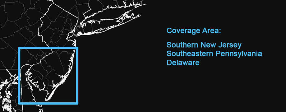
This map covers the Southern New Jersey region and was created as a replacement for the discontinued hybrid maps from MapBox and HERE. It features roads, towns, openspace and other features overlaid on recent aerial orthoimagery from the USDA National Agriculture Imagery Program (NAIP).
Note: This map will be expanded to full US Mid Atlantic coverage later in 2025.
Distribution Liability
Map software is provided "as is", without any express or implied warranty. In no event will boydsmaps.com be held liable for any damages arising from the use of this software. The user assumes all risks associated with the use of this software. boydsmaps.com will not be held responsible for any inaccuracies and no responsibility is assumed for damages or other liabilities due to errors, installation, accuracy, availability, use or misuse of the data presented.
The user should not assume they are permitted to drive or walk on a road or trail just because it appears on this map. Some of the roads and trails shown may be on private property or may have regulations prohibiting vehicular or other use. Some roads may not be passable and could be dangerous. It is the sole responsibility of the user to determine the suitability of any road shown on this map.
Boundaries shown for parcels, openspace and military installations are approximate and may contain significant errors. Some areas indicated as openspace may be not be open to access by the general public. It is the responsibility of the user to independently determine if they are permitted in these areas.
This map contains NJDEP Bureau of GIS digital data but has not been verified by NJDEP and is not state-authorized.