Cook's Map of the Pines
© 2019 Boyd Ostroff
Data Source
This map is locally hosted at boydsmaps.com
Link to this metadata:
boydsmaps.com/mapinfo/cook.html
Link to this map:
boydsmaps.com/#14.00/39.975683/-74.366832/cook/0.00/0.00
Originally published:
March 3, 2019
Most recent update:
none
Resolution:
16 feet (4.8 meters)
Map Tiles:
32,000
Size:
2.19 gb
Description
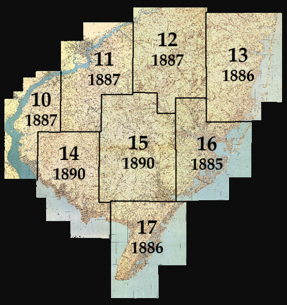
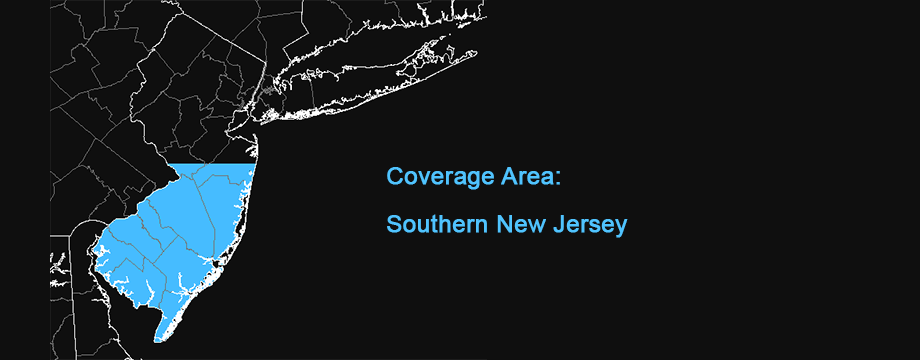
Cook's Map of the Pines is based on eight overlapping maps by geologist George H. Cook and topographer C. C. Vermeule for the Geological Survey of New Jersey during the period 1885-1890. Starting with PDF files from the New Jersey Environmental Digital Library at Rutgers University, each map was precisely georeferenced, cropped and stitched into a seamless map of Southern New Jersey.
The precision georeferencing process involved matching more than 4,000 features with high-resolution contemporary data, correcting substantial errors in original maps. This process created some distortion in parts of the map that had significant errors, as manifested by stretched text and grid lines that aren't straight (the thin blue lines show the correct location of the grid).
But the goal of this project was the creation of an accurate nineteenth century map that would line up with modern aerial imagery. A notable feature of the Cook/Vermeule maps is their representation of landcover. The little trees aren't just a decorative element, they're a visual representation of the density and proportion of coniferous and deciduous trees in the forest.
Credits
Original maps from the New Jersey Environmental Digital Library at Rutgers University: https://njedl.rutgers.edu/
Use Constraints
This map is © 2019 Boyd Ostroff with all rights reserved. It is provided free of charge for personal, non-commercial, non-organizational use but is not open source software. It may not be published or re-distributed in any form without the written consent of the author. Reasonable usage of map screenshots is permitted as long as they are attributed to boydsmaps.com (preferably with a link to the actual map).
Distribution Liability
Map software is provided "as is", without any express or implied warranty. In no event will boydsmaps.com be held liable for any damages arising from the use of this software. The user assumes all risks associated with the use of this software. boydsmaps.com will not be held responsible for any inaccuracies and no responsibility is assumed for damages or other liabilities due to errors, installation, accuracy, availability, use or misuse of the data presented.