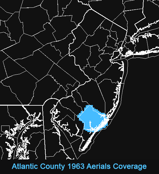
1963 aerial view of Atlantic County, New Jersey
© 2025 Boyd Ostroff
This map is hosted locally at boydsmaps.com
Link to this metadata:
boydsmaps.com/mapinfo/ac1963.html
Link to this map:
boydsmaps.com/#17.00/39.449857/-74.725379/ac1963/0.00/0.00
Originally published:
April 30, 2025
Most recent update:
none
Resolution:
4 feet (1.2 meters)
Map Tiles:
76,000
Size:
2.81 gb
Data Sources
Primary imagery source:
Atlantic County New Jersey, Office of GIS
1963 aerial view of Atlantic County, New Jersey
acogis.maps.arcgis.com/home/item.html?id=
Supplemental imagery source:
Atlantic County New Jersey, Office of GIS
1968 aerial view of Atlantic County, New Jersey
acogis.maps.arcgis.com/home/item.html?id=
Topographic basemap source:
US Geological Survey
Historical Topographic Maps - Preserving the Past
www.usgs.gov/programs/national-geospatial-program/
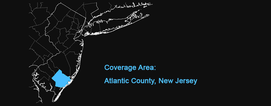
Description
1963 aerial imagery of Atlantic County New Jersey was overlaid on monochrome USGS 1:62500 scale topographic map quadrangles from the period 1941-1948. Unfortunately, we don't have any further details regarding the source of the original imagery.
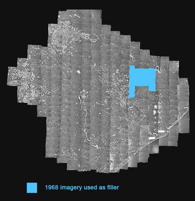
The section of missing imagery shown in blue below was filled with 1968 Atlantic County aerials.
This map is one of five historical aerial views of Atlantic County that boydsmaps published in April 2025. Normally, we don' publish maps of such small areas, but there are a number of historical details in this imagery that aren't available elsewhere. We would like to expand these maps to a larger area in the future, but have not found additional imagery sources yet.
Credits
Atlantic County Office of GIS in cooperation with the Cape Atlantic Conservation District
USGS Historical Topographic Map Collection
Distribution Liability
Map software is provided "as is", without any express or implied warranty. In no event will boydsmaps.com be held liable for any damages arising from the use of this software. The user assumes all risks associated with the use of this software. boydsmaps.com will not be held responsible for any inaccuracies and no responsibility is assumed for damages or other liabilities due to errors, installation, accuracy, availability, use or misuse of the data presented.