About Boyd
A native of St. Louis Missouri, Boyd holds a Bachelor of Arts from the University of Virginia and a Master of Fine Arts from Carnegie-Mellon University. His 40-year career in the theatre was capped by 18 years as Director of Design and Technology for the Opera Company of Philadelphia until retirement in 2011. His scenic designs have appeared in 190 productions by 78 opera companies throughout North America. A resident of the New Jersey Pine Barrens for over 30 years, Boyd's free Garmin maps of that region date back to 2008 and have been downloaded over 65,000 times at gpsfiledepot.com.
boydmaps history
The boydsmaps.com domain was registered in 2010 and the public site debuted in 2013 with a LIDAR-based map of Pine Barrens terrain using the Google Maps API. In the following years, our Garmin maps were gradually discontinued as we felt their format was too limited and their devices too expensive. For awhile, boydsmaps offered downloadable maps for smartphones but ultimately discontinued these as well. With so many different map formats, we used the open source Mobile Atlas Creator as a distribution format. But it just seemed too buggy and confusing, limiting the audience.
By 2019, we realized that browser-based maps could reach a much larger audience and online.boydsmaps.com launched, followed by mobile.boydsmaps.com for smartphones. By 2021, all downloadable maps were finally discontinued and the separate subdomains were merged into a single web app at boydsmaps.com.
In 2022, over 200 remotely-hosted maps were available, including the full suite of commercial products from here.com and mapbox.com. Several specialized apps were added in 2023, including MapSync, the 3d terrain viewer and PinesXT. Locally-hosted maps on the boydsmaps server increased from 80 megabytes to a terabyte by 2023, growing to two terabytes during 2024.
January 2024 marked a big change with the discontinuation of maps from here.com and mapbox.com. These maps were on a trajectory to exceed their monthly quotas of free data which would have resulted in significant charges. Unfortunately, discontinuing these maps made it impossible to properly cover the entire world, so our focus began shifting to the United States.
In early 2025, another major source of remotely-hosted maps made some changes that were incompatible with boydsmaps. We replaced their maps with locally hosted versions and this pointed to a new direction, where we will no longer depend on resources beyond our own control.
Looking ahead
Above all, we want boydsmaps to offer a good user experience with unique maps that load fast and are always available. You should be able to leave the menu open and "channel surf" through the maps. That's difficult when maps are hosted on remote servers with inconsistent performance and changing configurations, so we have moved away from them in favor of our own maps. Practically speaking, maps require a lot of expensive disk space which limits the geographic area we can cover. But we'd rather do a good job serving a small region than a mediocre job on a big one.
As of 2025, our new focus has been the Northeastern United States, which is home to over 65 million people and a popular tourist destination. We have removed most remotely-hosted maps with the exception of maps from USGS servers. We plan to continue offering the USGS aerials, LIDAR and topo maps for basic coverage of the United States, however they could be discontinued if there are access problems in the future.
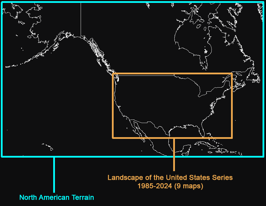
In spite of this new Northeastern focus, we recently completed the Landscape Series, with a map of the United States for each year from 1985 through 2024. Although the resolution is relatively low, these maps provide a unique view of our changing landscape on a regional scale.
The current inventory of maps is summarized below. We host a total of about 3 terabytes of maps - more than 159 million individual map tiles. These numbers will continue to grow throughout 2026 as we add new maps and expand the coverage of our smaller maps in the months ahead.
Locally-hosted map availability

Lower resolution locally-hosted maps
Recent updates
2/8/2026
Updated the 2006 NAIP Aerials with extended Northern coverage, including full imagery for Connecticut, Massachussets and Rhode Island (over 7 million map tiles).
2/1/2026
Added the new 2019 NAIP Aerials with extended Mid Atlantic coverage (about 5.7 million map tiles).
1/20/2026
Added the new 2013 NAIP Aerials with the same extended Mid Atlantic coverage as the 2023-2025 aerials (about 5.7 million map tiles).
1/12/2026
Added the new 2023-2025 NAIP Aerials with full coverage of New Jersey, Massachussets, Connecticut, Rhode Island and partial coverage of New York, Pennsylvania, Maryland, Delaware, New Hampshire and Vermont (over 6.5 million map tiles).
1/10/2026
Added a few features to the sync app. It now shows the name of each map in the top left corner and the zoom level at the top right. It also has the same multi-colored map menu as the main app now.
10/15/2025
Updated the sync app to add keyboard control of map movement with the cursor keys and zoom using page up/down or plus/minus keys.
10/13/2025
Added the new US Landscape Topo Basemap which combines 2024 NLCD data and ASTER GDEM terrain with geodata from a variety of different sources.
10/2/2025
boydsmaps migrated to a new server on the host's enterprise network infrastructure with redundant hardware and RAID-10 SSD's. There was little or no downtime involved with the move.
7/31/2025
More than tripled the size of the NHAP 1980's aerials, adding full coverage of Connecticut, Rhode Island, Massachussets and more (over 7 million map tiles).
7/7/2025 - 7/20/2025
Completed the Landscape of the United States series which now includes 40 annual maps covering the years 1985 through 2024 (18.5 million map tiles). Also introduced a 1970's Landscape map based on legacy USGS data.
7/4/2025
To celebrate Independence Day we released the Landscape of the United States series, showing the changing face of America in 9 maps from 1985 - 2024. Also introduced the new multi-colored map menu.
6/15/2025
Expanded the USGS 24k DRG Topo to cover the entire Northeast US region - a total of over 4000 USGS 7.5 minute quadrangles (more than 7 million map tiles).
5/26/2025
Added a new mid Atlantic 24k DRG Topo Map based on the Digital Raster Graphics standard used by the USGS to create their first online topo's during 1995-1998.
5/22/2025
Added a blue-tinted 250k basemap to the Kobbe 1889 Topo to fill in the blank areas on this irregularly-shaped map. Also intoduced the Terraserver legacy link translator for opening dead links to the Microsoft Terraserver USA website, which no longer exists.
5/10/2025
Expanded the NJ 2006 NAIP imagery to cover the entire mid-Atlantic region (about 5 million map tiles). Changed the map menu: when it's open, it now updates in realtime to show availability as you drag the map around.
5/3/2025
Added new 1968 and 1977 aerial imagery of Atlantic County, NJ
4/30/2025
Added new 1940, 1957 and 1963 aerial imagery of Atlantic County, NJ
4/23/2025
Expanded the NJ 2010 NAIP imagery to cover the entire mid-Atlantic region (about 5 million map tiles). Also introduced new, simplified map menu options.
4/15/2025
Added new mid-Atlantic 2017 NAIP imagery (about 5 million map tiles)
By accessing boydsmaps.com, you agree to be bound by the following Terms of Use:
boydsmaps.com ("the site" or "the app") is owned and operated by Boyd Ostroff ("management") and access is only granted for personal, non-commercial, non-institutional use. Unless explicitly noted otherwise, all computer code, maps and other content on the site are copyright © 2025 by Boyd Ostroff with all rights reserved.
The app is provided "as-is", without any express or implied warranty. In no event will management be held liable for any damages arising from use of the site. Maps on the site do not contain survey grade data and no representations are made as to positional or vertical accuracy. The user assumes all risks associated with usage of the app. Management will not be held responsible for any map, data or code errors and no responsibility is assumed for damages or other liabilities due to availability, accuracy, cyber-security, use or misuse of the site or app and their content.
Locally-hosted maps are only available for use within the app and bulk downloading of map tiles is strictly prohibited. Activity that suggests a user is attempting to download map data in this fashion may result in a permanent block on their IP address. Suspicious or malicious user access outside of normal app functions may also result in permanent blockage. All decisions to block access are final and there is no appeal process.
The user should not assume they are permitted to drive or walk on a road or trail just because it appears on a map. It is the sole responsibility of the user to determine access constraints of any road shown on the maps. Boundaries for parcels, open space, military installations and other features are approximate and may contain significant errors. It is the responsibility of the user to independently determine if they are permitted in these areas.
The user acknowledges that the app is beta software currently under development, which may affect its stability and availability. Use the app at your own risk in the field; be sure to have another app or device available in the event that the app does not work properly.
The app requires an active data connection to function and it is the sole responsibility of the user to determine the impact on their cellular or other data plan to insure that limits are not exceeded. Management will not be responsible for any data charges related to your use of the app.
The site is uses the open source Maptalks API to display the map on your screen. Maptalks is licensed under the BSD 3-Clause "New" or "Revised" License as follows:
Maptalks is copyright © 2016, maptalks, All rights reserved. Redistribution and use in source and binary forms, with or without modification, are permitted provided that the following conditions are met:
* Redistributions of source code must retain the above copyright notice, this list of conditions and the following disclaimer.
* Redistributions in binary form must reproduce the above copyright notice, this list of conditions and the following disclaimer in the documentation and/or other materials provided with the distribution.
* Neither the name of maptalks.js nor the names of its contributors may be used to endorse or promote products derived from this software without specific prior written permission.
THIS SOFTWARE IS PROVIDED BY THE COPYRIGHT HOLDERS AND CONTRIBUTORS "AS IS" AND ANY EXPRESS OR IMPLIED WARRANTIES, INCLUDING, BUT NOT LIMITED TO, THE IMPLIED WARRANTIES OF MERCHANTABILITY AND FITNESS FOR A PARTICULAR PURPOSE ARE DISCLAIMED. IN NO EVENT SHALL THE COPYRIGHT OWNER OR CONTRIBUTORS BE LIABLE FOR ANY DIRECT, INDIRECT, INCIDENTAL, SPECIAL, EXEMPLARY, OR CONSEQUENTIAL DAMAGES (INCLUDING, BUT NOT LIMITED TO, PROCUREMENT OF SUBSTITUTE GOODS OR SERVICES; LOSS OF USE, DATA, OR PROFITS; OR BUSINESS INTERRUPTION) HOWEVER CAUSED AND ON ANY THEORY OF LIABILITY, WHETHER IN CONTRACT, STRICT LIABILITY, OR TORT (INCLUDING NEGLIGENCE OR OTHERWISE) ARISING IN ANY WAY OUT OF THE USE OF THIS SOFTWARE, EVEN IF ADVISED OF THE POSSIBILITY OF SUCH DAMAGE.
Our three-dimensional maps use the Mapbox GL JS SDK. Mapbox GL JS 2.0 is Copyright © 2020, Mapbox, all rights reserved. For the full license terms, please see the Mapbox Terms of Service at www.mapbox.com/legal/tos/.
boydsmaps.com does not collect any personally identifiable information and does not share data with any other parties. The site is privately-owned, not affiliated with any company or organization and has no advertising partners. Since there are no user accounts or registration, we don't have any of your personal information.
In order to display your position on the map, you must allow boydsmaps.com to use your location. When you activate GPS Tracking, you will receive an alert requesting permission to use your location. boydsmaps.com does not use your location data for any purpose other than the display of a pointer on the map and does not share this data with any other party.
When a map is displayed on the screen, your browser requests a series of image tiles from the map server. These tiles are logged along with the IP address that requested them. This data is only logged when you view maps that are locally hosted at boydsmaps.com. If you view a remotely-hosted map from another server (such as the US Geological Survey, for example) boydsmaps.com does not see this data but the remote server may record similar log entries. There are numerous ways to obscure your real IP address if you're concerned about privacy.
Data from the logfile at boydsmaps.com is aggregated and used to better understand site usage patterns. This data is only available to the site owner and is not shared with any third parties.
boydsmaps.com uses the localstorage API to store user preferences and waypoint data in your browser on your device. This data is only accessible to the user of the device and no data is sent to or stored on the boydsmaps server. boydsmaps.com does not store any cookies in your browser. The following data is stored on your device and used by the boydsmaps app. If you use private or anonymous browsing, the app will not function correctly because data is not saved when your session ends.
If you view 3d maps, the Mapbox API may store data on your device for their own purposes. This data is not used by the boydsmaps app. See sections 1.5 and 2.5 of the Mapbox privacy policy for information about data usage by their API and SDK.